Sometimes you need to break away from routine and just head out on an impromptu road trip for the day....
The Jemez Mountains are a volcanic range just about an hour north of Albuquerque. The region is prone to fires in the spring because of the tendency of the weather to be dry and windy during that time. The fire risk was indeed rated high the day we went, but we did not encounter any problems. We did see evidence of past fires in the higher ranges - vast portions of blackened trees with new undergrowth and trees growing up around the stumps and broken, jagged trunks. The Jemez is home to several amazing areas to explore (from Wikipedia):
Much of the range is federal land, including Santa Fe National Forest, Bandelier National Monument, and the Valles Caldera National Preserve. State lands include Fenton Lake State Park. There is also to the west the town of Jemez Springs and to the east, Los Alamos and the Los Alamos National Laboratory where the first atomic bomb was created; as well as the pueblos of Santa Clara and Jemez.

I headed out with my friend, Sandra, taking I-25 North out of Albuquerque to 550 West for 20 miles, then turning right on Route 4. The first stop was the Walatowa Visitor Center at the Pueblo of Jemez. We needed a map, some information about the area, and to know where or even if photography was allowed. On many of the Pueblo lands (or reservations if you want to call them that), photography is prohibited completely. Some Pueblos allow it only in certain areas, but never at a ceremony or dance or someone's home. And other Pueblos require you to purchase a permit - usually about $10. in Jemez Pueblo, the only area for photography was the Red Rocks area right around the visitor center. So after grabbing some maps, talking with the indians at the Center, purchasing a few cards, etc, we set up the camera and snapped some photos of the Red Rocks area. The sky was a brilliant blue so typical of New Mexico.


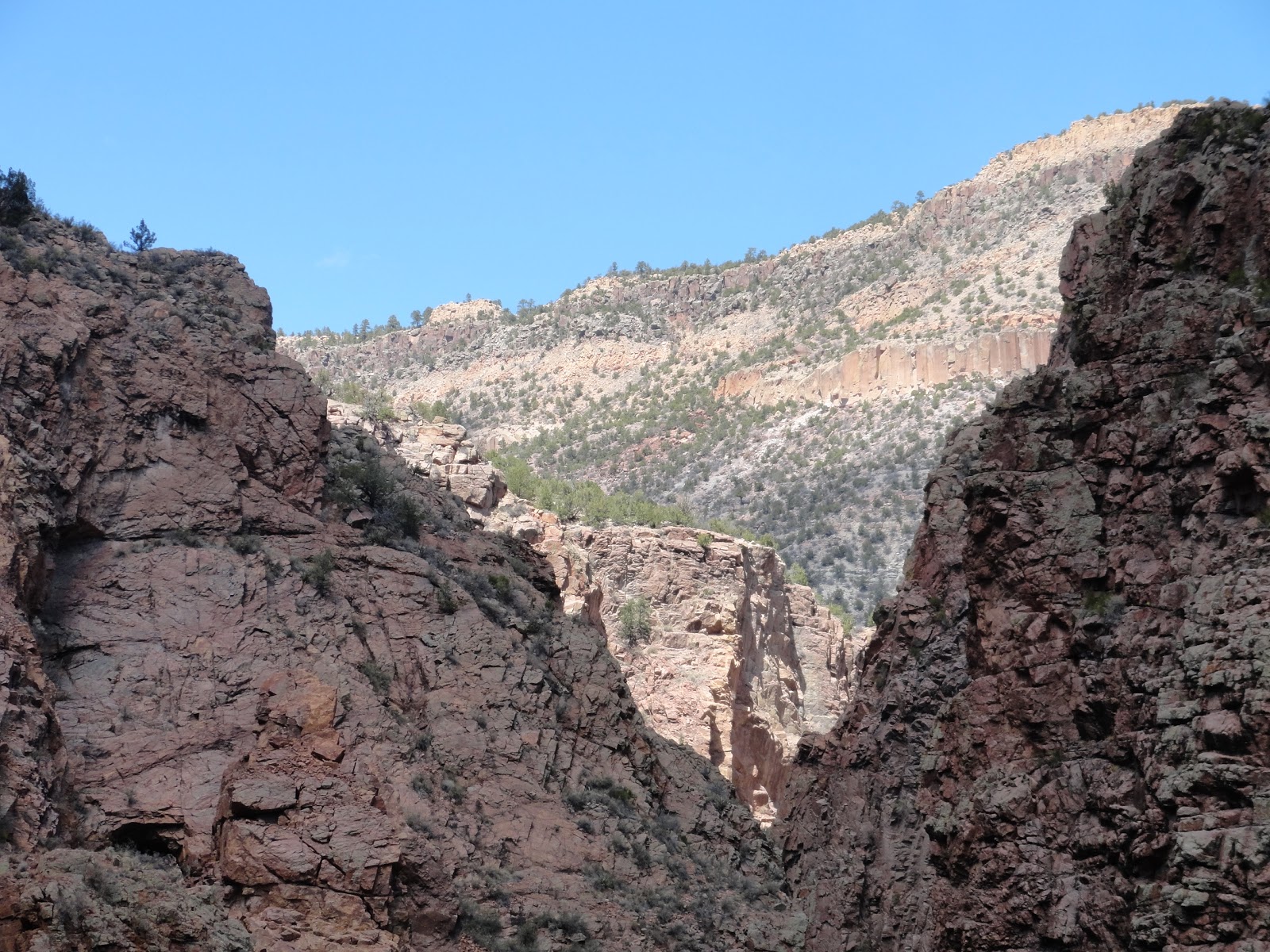
Sandra remembered that the Gilman Tunnels was really cool to see. So we checked the map, headed back up Hwy 4 and turned left off the National Scenic Byway onto Rte 485. No pictures here as we were still on Pueblo Land until we got near the tunnel. The Gilman Tunnels were originally blasted through the rock in the 1920s as part of a logging rail line. It was also used as a setting in the film 3:10 to Yuma. Approaching the tunnels, the winding road begins to follow the Guadalupe river to the right. Just prior to the tunnels it becomes a single lane road with plenty of pulloffs to allow for passing vehicles. We stopped just in front of the tunnels to take in the gorgeous scenery. Sun shining brightly. No sounds except the roaring of the river far below. A slight breeze kept us cool as we sat and watched the bright white clouds, the occasional butterfly and a slow, wheeling hawk in the sky. It seemed a good place to us to pause and grab the sandwiches from the cooler and just relax a bit and sink into nature....


 And then into the tunnels!!


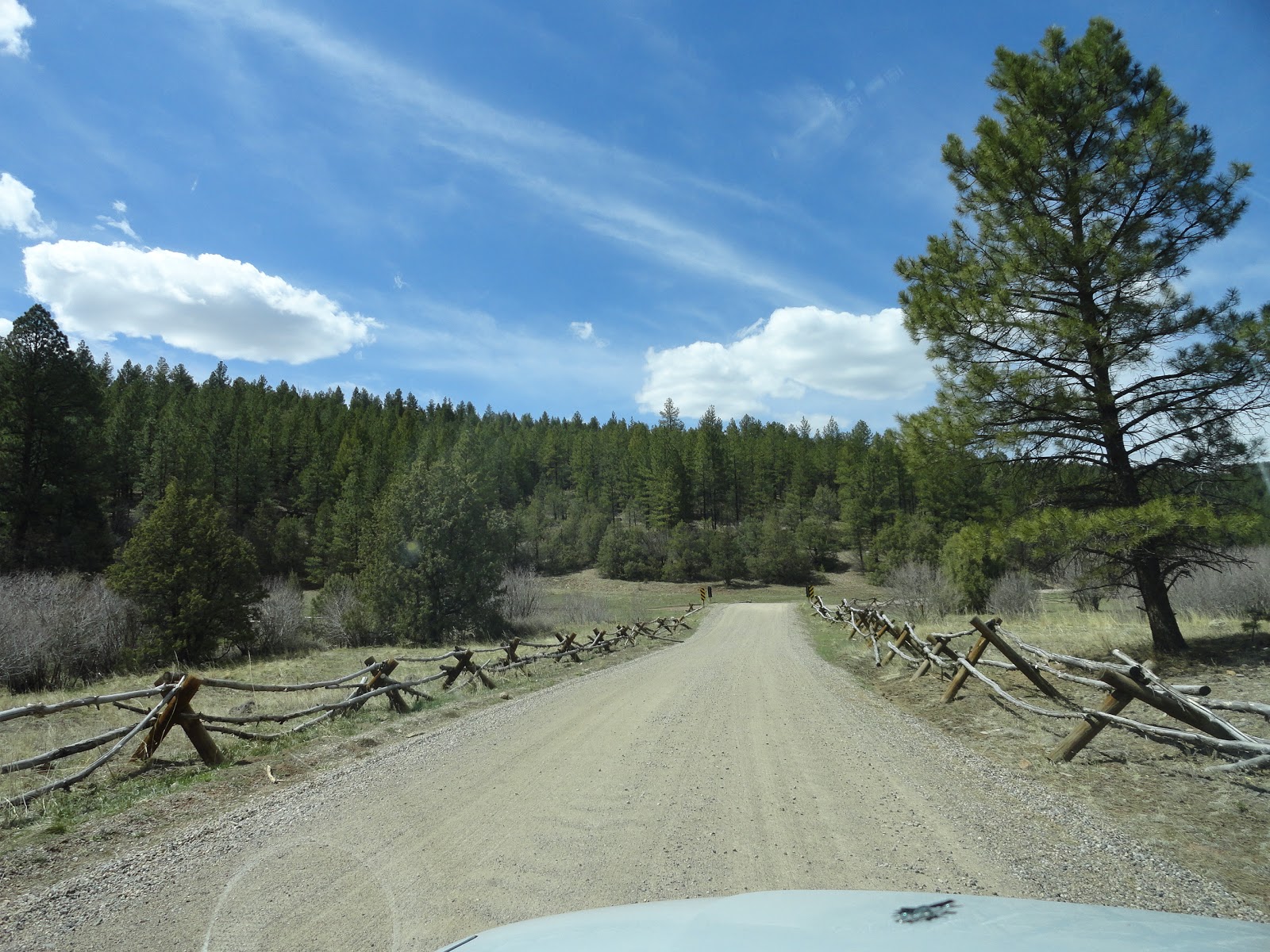
Not far on the other side of the tunnels, the paved road turns to dirt. On the map, it looks like a short jaunt up to Rte 126, which then connects back with Hwy 4. Be forewarned. It's actually about 20 miles or so of washboard dirt road. In my little car, we couldn't go more than 20 mph - and most of the time less than that or the shaking would bounce us sideways off the road. Of course, it was our own fault for not asking questions or reading a serious map, etc, etc.... but we did enjoy seeing lots of campers off to the side as it wound up, up, up into the mountain range south of La Cueva. The temperature dropped about 20 degrees. We saw a red long horn steer in the woods grazing - no one else around, not even another cow. I stopped for Sandra to take pictures and for a bit he stared us down and then decided we weren't worth it. Good thing. I don't think the Ghost would have survived those horns! My mantra every time the bumps got really bad...."I gotta get a Jeep. I gotta get a Jeep."

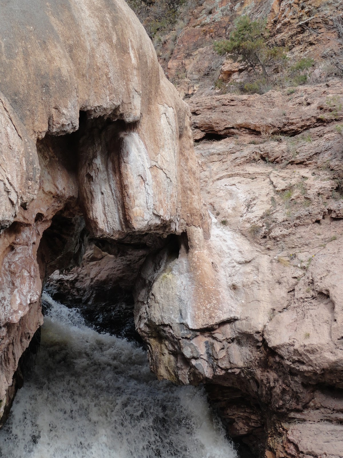
 We passed several patches of snow off to the sides. And the road was muddier near those. Just when I was about to give up (an hour later) and turn around, we made it to the paved road of Rte 126. A quick jaunt down some windy roads and we were back on Hwy 4 heading south. Here we passed Battleship Rock, Soda Dam and the Jemez State Monument (where I have gone the last two Decembers to the Luminaria Christmas celebration). We stopped at Soda Dam to see the water fall. Be sure to click on the link for Soda Dam above - it's really interesting about it's formation. This whole area is rife with hot springs. Indeed, with the windows down, it smelled strongly of sulphur!


 After that we passed briefly through the town of Jemez Springs, stopping in at the friendly coffee shop for a drink. I hope to return to Jemez Springs sometime soon and actually take advantage of one of the many public or private hot springs available to soak away some stress. For now though, the day was beginning to wane and I still had to make it back in time to pick up Jane (my dog) at daycare. Until next time....
Jules
The Jemez Mountains are a volcanic range just about an hour north of Albuquerque. The region is prone to fires in the spring because of the tendency of the weather to be dry and windy during that time. The fire risk was indeed rated high the day we went, but we did not encounter any problems. We did see evidence of past fires in the higher ranges - vast portions of blackened trees with new undergrowth and trees growing up around the stumps and broken, jagged trunks. The Jemez is home to several amazing areas to explore (from Wikipedia):
Much of the range is federal land, including Santa Fe National Forest, Bandelier National Monument, and the Valles Caldera National Preserve. State lands include Fenton Lake State Park. There is also to the west the town of Jemez Springs and to the east, Los Alamos and the Los Alamos National Laboratory where the first atomic bomb was created; as well as the pueblos of Santa Clara and Jemez.

I headed out with my friend, Sandra, taking I-25 North out of Albuquerque to 550 West for 20 miles, then turning right on Route 4. The first stop was the Walatowa Visitor Center at the Pueblo of Jemez. We needed a map, some information about the area, and to know where or even if photography was allowed. On many of the Pueblo lands (or reservations if you want to call them that), photography is prohibited completely. Some Pueblos allow it only in certain areas, but never at a ceremony or dance or someone's home. And other Pueblos require you to purchase a permit - usually about $10. in Jemez Pueblo, the only area for photography was the Red Rocks area right around the visitor center. So after grabbing some maps, talking with the indians at the Center, purchasing a few cards, etc, we set up the camera and snapped some photos of the Red Rocks area. The sky was a brilliant blue so typical of New Mexico.


Sandra remembered that the Gilman Tunnels was really cool to see. So we checked the map, headed back up Hwy 4 and turned left off the National Scenic Byway onto Rte 485. No pictures here as we were still on Pueblo Land until we got near the tunnel. The Gilman Tunnels were originally blasted through the rock in the 1920s as part of a logging rail line. It was also used as a setting in the film 3:10 to Yuma. Approaching the tunnels, the winding road begins to follow the Guadalupe river to the right. Just prior to the tunnels it becomes a single lane road with plenty of pulloffs to allow for passing vehicles. We stopped just in front of the tunnels to take in the gorgeous scenery. Sun shining brightly. No sounds except the roaring of the river far below. A slight breeze kept us cool as we sat and watched the bright white clouds, the occasional butterfly and a slow, wheeling hawk in the sky. It seemed a good place to us to pause and grab the sandwiches from the cooler and just relax a bit and sink into nature....


Not far on the other side of the tunnels, the paved road turns to dirt. On the map, it looks like a short jaunt up to Rte 126, which then connects back with Hwy 4. Be forewarned. It's actually about 20 miles or so of washboard dirt road. In my little car, we couldn't go more than 20 mph - and most of the time less than that or the shaking would bounce us sideways off the road. Of course, it was our own fault for not asking questions or reading a serious map, etc, etc.... but we did enjoy seeing lots of campers off to the side as it wound up, up, up into the mountain range south of La Cueva. The temperature dropped about 20 degrees. We saw a red long horn steer in the woods grazing - no one else around, not even another cow. I stopped for Sandra to take pictures and for a bit he stared us down and then decided we weren't worth it. Good thing. I don't think the Ghost would have survived those horns! My mantra every time the bumps got really bad...."I gotta get a Jeep. I gotta get a Jeep."


Jules
No comments:
Post a Comment